Posts from — February 2011
Findings at Machu Picchu
It was still misty when we entered the site of Machu Picchu. The only real indication that there might be something different, around us was the sudden absence of foliage, which had given way to orderly terraces.
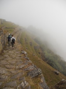
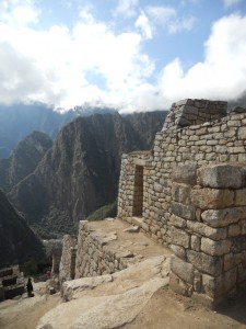
What we couldn’t see was the arching complex of building and walls, walkways and aqueducts. It wasn’t until we walked out to the edge of a giant rock pulled, out the binoculars, and peered down into the mist, that the familiar shapes, filed in our brains from the pages of textbooks and travel programs, began to emerge.
While the mist thinned under the rising sun, we explored the upper terraces.
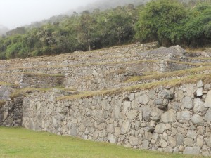
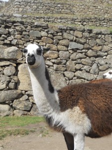
The irregular rocks were fitted expertly into each other, forming tall, solid terrace walls. The only rocks protruding from the sides were there by design – steps to climb from one level to the next. The grasses were short and thick, and scattered with piles of smooth black pellets, evidence of the llamas that inhabit the ancient site.
Before entering the lower site, we checked our packs, and looked for Kelly, our fellow-traveler who had stayed behind in Cuzco while LeAnna and I hiked the trail. We’d planned ahead of time to meet at the main gate. But we were late, and Kelly was nowhere to be seen. After about 20 minutes, we checked with Odon, who called the tour office to check for messages. Then we called the hotel. Nothing. I even tried to see if we could cross reference ticket numbers to determine if she’d already entered the site. No luck.
I loaded a small pack for the 6 hours we’d spend inside the site, making sure to pack my binoculars. They might be our only hope of finding that day Kelly.  Then we reentered Machu Picchu, the sun beginning to stream through the clouds.
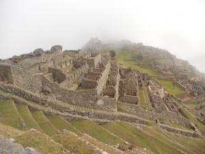
The site was massive. Odon served as our guide for the first two hours. He took us through the noble houses, where the stones were smoothed from the rough-hewn blocks that made up the majority of the buildings, and then into the sun temple, where the stones were polished even further, indicating the deeply sacred nature of the space.
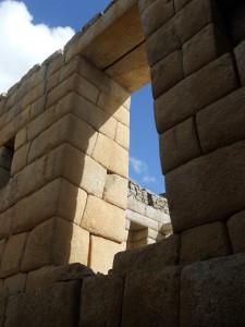
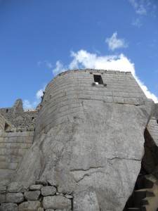
One theory about Machu Picchu is that it was the city of the Inka. Like, THE Inka. The dude in charge of the empire. That this place was where the most sacred priests lived, and where the family of the Inka lived. Nobody really knows, but there are a lot of temples there. There was the Sun Temple, climbing organically out of a large rock base in the middle of the site.
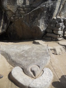
The temple of the Condor, where blood would be fed to the condor through the little hole at its beak that leads to an underground cavern (the stomach), which would hold the rest of the offering.
The main temple,

with it’s sacred sundial (which was damaged during the making of a car commercial – for real).

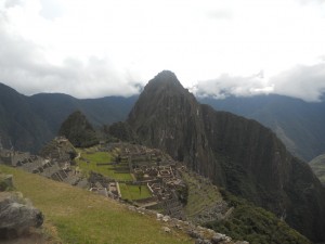
Machu Picchu is home to a number of other sacred rocks. Those that look like the actual sacred mountains that surround them.

The sacred rock is in the lower right hand corner, mirroring the shape of the mountain in the middle.
Rocks that, when lain upon transfer the energy of the earth.
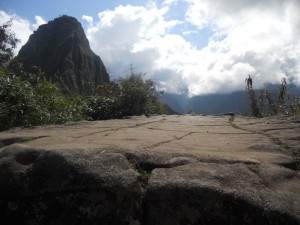
And those that, by their energetic makeup are believed to impart power to individuals who touch them.
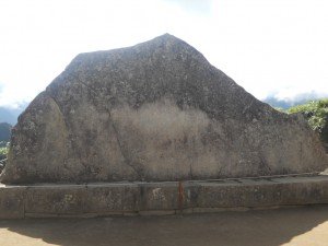
One such rock sits at the base of the trail to Huayna Picchu, the tall spire of a mountain at the back of the site.
The stone, which shows visible sign of centuries of human hands touching its surface, is part of a resting area, a meditative retreat believed to help prepare travelers for the difficult hike to the top of the mountain, and the Temple of the Moon.
Odon warned us against touching the stone. “You have to have the right makeup – the right energy.â€Â He told us that the high quartz content of the stone could make you feel sick if you weren’t ready for it.
Nobody in our group saw the Temple of the Moon, not because we didn’t want to, but because the government has greatly restricted the number of people who can climb the trail each day. In order to get a ticket, you have to be at the Machu Picchu gates around 5:30am.
So we were relegated to the lower site, with its llamas and terraces.
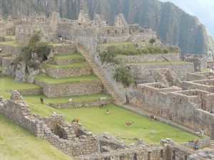
At one point, one of the llamas, who roam free throughout the site, stepped across the path, separating our group for a good 5 minutes, before it decided to move along.
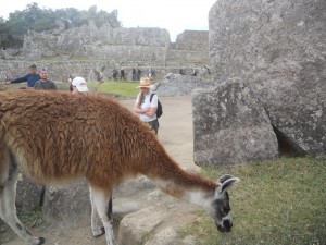
One of the women in the group called to those of us nearest to just move past it. The guy next to me looked over and said, “You go ahead. I raise llamas. I have no intention of getting kicked in the head.â€Â So we waited until we were allowed to move to our next stop.
While we walked, we were constantly scanning the site for Kelly. She was there somewhere, in a straw cowboy hat, and a red backpack. I was quite certain we could find her, if we kept the binoculars handy, and kept a steady eye out for her. But the pure vastness of the place, with its sharp turns and steep angles made it difficult to see much.
To make matters slightly more challenging, Odon informed us that, very soon, 10,000 new visitors would be arriving, making it virtually impossible to find anyone.
Just as we were winding down our visit, deciding that we’d be more likely to find Kelly in the tiny streets of Aguas Calientes, the town at the base of the mountain, I spotted her through my binoculars.
“No way. She’s there!â€Â Climbing the steps to the main temple, Kelly’s hat and backpack made her stick out. LeAnna and I ran through the site, (until we were stopped by guards) catching Kelly’s attention, ugly-American style, by jumping and waiving from below the temple.
“Where were you? Sorry we were late! We’ve been searching for you.â€
“Didn’t you get my note?â€Â Kelly looked at us a little baffled. “I left it for you at the bag check.â€
Of course she did. It was the thing that made the most sense. And the one thing we hadn’t checked. Brilliant.
As it turned out, Kelly, unable to make the three-day trek with us, had scored one of the coveted tickets to the top of Huayna Picchu and the Temple of the Moon.
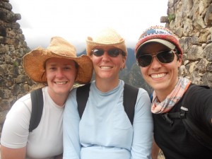
We compared notes on what parts of the site we had seen, and made a plan that would take us through the rest and get us on a bus to the town in time for a final meal with our group.
Our last, winding walk through Machu Picchu was hauntingly memorable. We found beautiful, framed views,
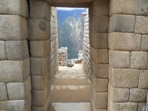
ancient rooms,
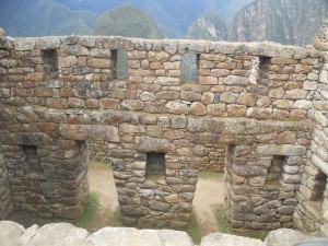
and amazingly preserved details.
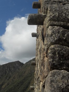
Even so, Machu Picchu, with its temples and stones, revealed nothing of its secrets to us. None of us became shamans. None of us had life-altering visions. But we did find each other. Amid the mysteries, in a spot of sunlight, we saw each other, before the mist returned to blanket Machu Picchu once more.
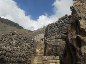
February 4, 2011 Comments Off on Findings at Machu Picchu
Lake Tekapo
Our last major destination in New Zealand was Lake Tekapo, the lake right next to Lake Pukaki.
The day, unlike the last few, started out grey, threatening rain the entire morning.
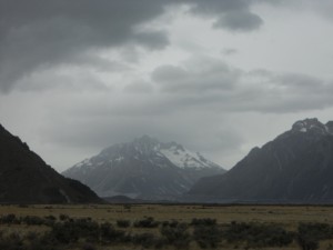
After a quick lesbian-saves-the-day moment when we changed the tire of a stranded German student, we hit the road, out around Pukaki. In the mist, the blue of the lake melted into the skyline.
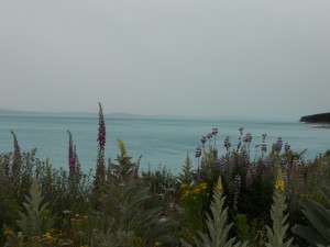
The water was tempting. Really, really tempting. Bouncing like a little kid, I kept asking when we could go for a swim. Krista’s good sense and the cloudy skies kept me from throwing myself in from the side of the road.
The mountains were gorgeous, the water was unearthly, and the lupine were overwhelming. As we drove closer to Tekapo, the lupine fields increased in frequency and size. We’d seen the flowers throughout the trip. Every time we saw them, they seemed more intense. We found ourselves on the side of the road on countless occasions, Krista snapping away and me collecting seed pods.
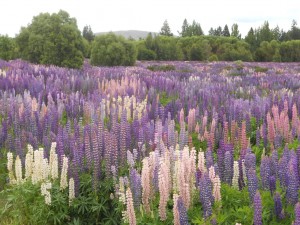
We arrived at the lake late in the day. W took a quick spin around the town, located some gluten-free pizza and filled our propane tank. Our night at Lake Tekapo was a rough one. Although we were able to find a secluded place to bathe in the lake, we were challenged mightily when it came to finding a place to sleep.
The Department of Conservation campsites, which had been so good to us for two weeks were nowhere to be found in the Lake Tekapo area. On the suggestion of a shopkeeper, we headed to a nearby lake to check out a pay-to-play campsite. We ended up doing no more than a drive-by. The boarded up trailers and vacant weekend homes weren’t encouraging.
Next, we drove around the other side of Tekapo, headed toward an off-season ski resort, and hoping to repeat our experience at Cardrona.
Instead, we were met with nearly unnavigable gravel roads, and no sign of a place to camp.
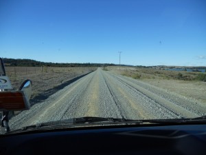
Eventually, we found a nook. A tiny gravel pit dug into the hill below the road. We parked next to the solo evergreen tree, towering 20 feet in the air. We thought this would be the most protected location for us, until about 2AM, when the wind, howling across the lake, and shaking our van, threatened to take the tree down.
Several van moves later, we found a level spot approximately 20 feet away from the tree, facing into the wind. After that, the rest of the night was tolerable. We were able to sleep, unafraid of being crushed in our sleep.
Lake Tekapo is best known for its chapel. The Church of the Good Shepherd sits on the lake’s shore, giving the congregation an amazing view.
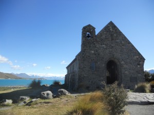
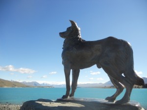
We spent a bit of time in the chapel and on the shores, inhaling the delicate honey smell of the lupine, and admiring the working dog memorial.
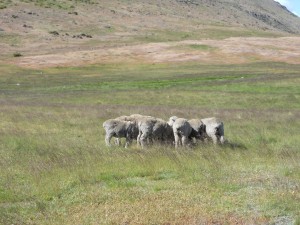
We ended our trip to Lake Tekapo at the Mount John University Observatory, high above the lake, the town and the valley. High, meant windy, however. Even the sheep were huddled and sheltering from the cold.
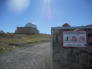
Leaving our aliens in the car, we walked around the campus.
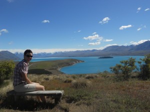
Up above, we were treated to a panoramic look at the area. We had a side-by-side comparison of lakes fed by glaciers and those not. We had a view of vast lupine fields. We had a view of the distant mountains.
For the last time, we took time to sit and take in our surroundings. With the wind blowing around us and the sun beating down on us, we were enveloped in New Zealand.
We left the observatory filled-up and grateful once again for all we had received on our trip. We would leave the next day for the states. But New Zealand was unlikely ever to leave us.
February 3, 2011 1 Comment
The eldest brother
One of New Zealand’s great natural sites is Aoraki: Mt. Cook.  Seen by the Maori as the eldest brother in the capsized canoe that came from the mythical homeland, Hawaiki, the mountain is sacred, the tallest in New Zealand.
Mt. Cook was high on our list of things to see/places to sleep. But only if the weather cooperated. The Mt. Cook region gets 60 days of sun each year. That’s 60 days where you can even see the sun at all. And, because of the South Island’s crazy insane weather systems, it can be nearly impossible to predict what the weather will be doing on any one part of the island at any given time.
When we headed toward the mountain form Dunedin and the south, the weather was beautiful. If the weather held, we would spend at least one night in a Department of Conservation campsite at the base of the mountain, one of the most popular camp sites in the country.
I drove and Krista scanned the guidebooks, deciding where we would stop to take pictures and evaluate the weather. There was a viewpoint that would allow us a peek up at the mountain from the southern tip of Lake Pukaki. If we could see the mountain, it was game on.
Pulling into the visitor center parking lot, we had our answer.
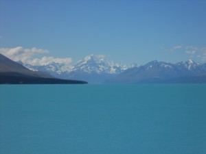
We’d seen the lake before the mountain. It was eerie blue, the kind of blue that comes only from the super-fine silt of glaciers. It looked like some kind of strange energy drink, electric and milky. I kept looking at it in disbelief, marveling at the trick of the light that made the water look so dense.
We were on our way to the mountain. If it looked great from a distance, we were going to see it up close, too. Back in the van, we scooted along the road to its terminus. New Zealand is an interesting place for a lot of reasons. It’s beautifully set up for travelers. The roads are good, but they take you to immensely remote and rugged places. It’s kind of like a huge theme park for would-be explorers.
Mt. Cook, while a major destination, has a large and well-outfitted campground, an enormous Conservation information center dedicated to the history of Sir Edmond Hillary (the first guy to summit Everest was a kiwi) a big-sized hotel/lodge, a couple of hostels, and a few restaurants. A handful of homes complete the village, presumably housing those who staff the hotel.
From the village we were treated to some excellent views of Mt. Cook and the surrounding mountains, complete with their spectacular hanging glaciers.
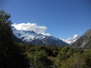
Per our usual routine, we checked in at the Department of Conservation info center to get a weather update and a suggested hike for the evening. The weather report was good. At least one day more of sun was expected, and we’d be able to get a great sunset view of Aoraki from Kea Point, a 30 minute hike from the campground.
So that’s where we headed. The sand flies, which had been gloriously absent for the past week, were still granting us a reprieve at the campsite as we cooked dinner and set up for the evening. The campsite even had fantastic flush-toilets and potable water. Our bellies and canteens full, we checked our watches, did some calculations and headed toward Kea Point, hoping for a bit of time to sit and take in the mountain as the sun climbed its slopes.
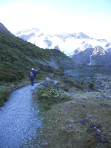
Kea Point was perfectly situated to watch the sunset. It sat just above a glacial lake, to the side of the mountain that blocked Aoraki from view at the campground. From the viewing platform, we looked out across the lake at Mueller Glacier and up at Mt. Cook.
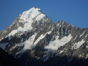
We looked at the hills and mountains all around us. And then we realized that we were standing too still, for too long. Sunset is precisely the time that the sand flies are the worst.
We tried to tough it out. We could tell by the light on the mountain that we had maybe 20 minutes before the sun would set completely and we might see some color on the beautiful glaciers.
Twenty minutes was too long to wait. We smacked each other and ran in circles trying to get the flies to dissipate, but it was no use. We breathed in the mountains and the delicate light on the glaciers, and then we made a break for it.
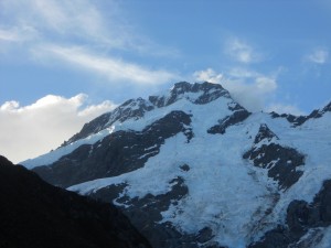
We’d see more of the mountain tomorrow.
***
The plan for the day was two-fold. First, head to the Tasman Glacier (New Zealand’s largest) for a view of Mt. Chudleigh and a gander at the icebergs. Yes, the icebergs.
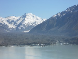
After a bit of a drive, it was a quick walk out to the glacier. Though it was the largest, it was covered in shale and other rock, disguising the vast amount of ice beneath. Only the floating chunks of ice, and glacial lake gave it away.
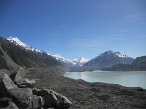
But the best view, in my mind, was the look back at the glacial valley. The flat-bottomed expanse left behind by the retreating glacier, and kept alive by the constant melt.
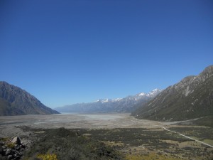
We took some time to sit and soak in the mountains and the sky. New Zealand is good for that. When the sky is clear, it’s the color blue that I’ve seen very few places. The sky, with white stretches that look like the spraycan function in Microsoft Paint, give name to the islands –  Aotearoa: land of the long white cloud.
The second part of our plan for the day was to find excellent views of the mountain. This required a long hike out to the Hooker Glacier, on the other side of Mt. Cook.
The space around the village and glaciers already felt remote, but the hike on this afternoon felt removed. It was almost as if we were arriving directly after the trail had been cut. Directly after the area had first been seen by people. It felt raw.
Immediately, scenes presented themselves to us and our cameras. The kind of scenes that could be – that probably are – postcards.
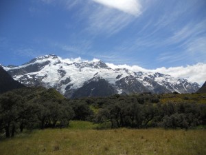
We crossed swing bridges spanning milky rivers and climbed through the spear ferns waiting for the mountain to come into view.
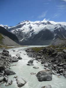
The wind that was keeping the skies so clear whipped around us, funneled across the ice and down the valley. The sun, working equally hard, beat down, warming us and giving the scene a vibrant, sometimes neon glow.
When the trail moved out from the hillside where it had been clinging, we saw what we were looking for. And, with every step, Aoraki presented itself more and more fully.
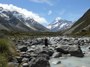
Right up until we reached the huge lake at the head of the glacier. I have no doubt we could have cut our hike in half, if we had been able to refrain from photographing the mountain every 3 seconds as the view changed. As it was, we kept snapping shots and gaping at each other.
Our timing, this day like most others on our trip, was ideal. We arrived at the base of the mountain as the few other people on the trail in front of us were leaving. It was quiet, but for the nagging of the wind, stretching the last, stubborn clouds across the sky.
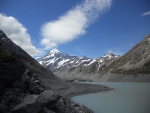
We picked a spot between two streams fed by waterfalls and sat to view the eldest brother.
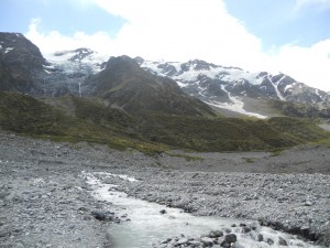
Filled up by the ancient mountains, we noticed the shift in the wind’s tone. Now more fierce than complaining, it told us it was time to leave. And, as we did, we watched the clouds that had threatened for hours to obscure the mountain slide closer. The mountain had been good to us.
Of the 60 days of sun the mountain would see that year, we had three of them. W e were grateful for our continuing good fortune.
Walking back to the campground, we were treated to more beautiful views, including the distant, fluorescent blue of Lake Pukaki.
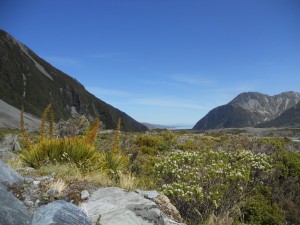
And, though we felt like explorers moving through New Zealand’s wilderness, we found ourselves at the base of the Mt. Cook alpine memorial, reminded of those who truly delved into the unknown in order to find the mountain.
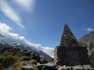
Grateful, we moved on, leaving the mountain to the clouds.
February 1, 2011 1 Comment


